14 March, 2010

Goodbye Melbourne

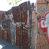
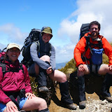
A couple of pictures from around Fitzroy and central Melbourne from my last weekend before leaving.

And from a last beer or two at the Mountain Goat brewery, one of my favourite places brewing one of my favourite drinks in Melbourne.

08 March, 2010

Healesville Sanctuary


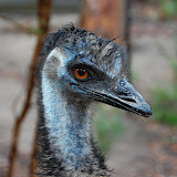
I'll back-date this post (and the next one) since I'm a month and a bit late in putting these pictures up. They're from Healesville Sanctuary, an excellent zoo of Australian wildlife about one hour's drive from central Melbourne.


The reptile house was great, as was the birds of prey display. In fact, I liked the whole place and Simon and I spent most of a day there without noticing the time pass.


The town of Healesville itself looked like a nice place for a day trip but turned out to be a bit of a disappointment when it came time to try and get some lunch. The first place we went to said their kitch closed for lunch at 1pm. The next place acted like it was a big deal for them to find us a table to eat at. (They didn't look that busy). We ended up at a place called Cheese Freakz (never a good indication) who served dull burgers and seemed to have nothing on the menu involving cheese. The animals more than made up for the crappy food though.


10-03 Healesville Sanctuary

04 March, 2010

Cyclist numbers up in Melbourne

In a follow-up to the comment I made on Tuesday about the annual Melbourne bike survey, The Age has the story Number of peak-hour cyclists soar.

The number of cyclists on Melbourne's roads has soared by up to 50 per cent during peak hour in the past year, according to new figures.


What they actually mean, is that the increase in numbers at some intersections was up to 50 percent. The overall increase in cyclist numbers will be somewhat less than that. None-the-less, it is great news for Melbourne. It's also good to see affirmation of the often observed point that the rate of cycle injuries has fallen as the total number of cyclists on the city's streets has increased. As usual, the explanation given is that when more people cycle, cyclists are more visible, drivers are more familiar with sharing the road with them, and the proportion of drivers who are also cyclists (and presumable interact more safely with cyclists) is greater.

Napier street, mentioned in the article, is next to where I live and is a wonderful example of successful cycle planning. The street runs parallel to two busy streets used heavily by cars. It has been broken at various points by traffic barriers which allow cyclists and pedestrians to pass through but stop cars using the street as a thoroughfare. Where Napier street crosses busy (about 6 lanes) Johnston street, there are cycle priority lanes at the traffic lights. Cyclists going straight ahead can press a button which means they will get priority over left turning traffic at the lights. The street has cycle lanes painted in both directions and regular traffic calming features such as speed bumps, as so the side streets connecting to it. The speed bumps are constructed with a gap between the end of the raised area and the side of the road (or the start of the parking areas) so that cyclists can avoid the discomfort that comes of riding over speed bumps.

I'd love to see concepts like this being used in Wellington. The pessimist in me suspects that while we have people at council making statements like "We shouldn't encourage people to cycle because it's dangerous for them" we won't be seeing much change. I note that Kerry Prendergast, who could hardly be described as having supported cycle friendly policies, (though she's big on building roads), is running for mayor again.

02 March, 2010

"Numbers expected to be up in annual bike count"

It's national bicycle counting day in Australia this article says: "Numbers expected to be up in annual bike count". It's also the first day since being here when I've taken the tram to work instead of cycling.

While I missed out on potentially being recorded as one of the many cyclists in Melbourne, I have some statistics of my own. Since moving to Fitzroy in early September I've cycled 2599.39km to and from work, taking a total of 102.95 hours for an average speed of 25.25km/hr (door-to-door). My average journey time is about the same as what people tell me it takes them to drive --- a bit over 30mins, my tram ride today took about an hour.

21 February, 2010

30 January, 2010

Warrnambool

A couple of weekends back, Simon, my housemate, and I caught the train out to Warrnambool. The coast road between Melbourne and Warrnambool is the Great Ocean Road tourist route. Our train took an inland route so we didn't get any ocean views until we got to Warrnambool, though we did get good views of some industrial areas on the fringe of Melbourne.

The coast around Warrnambool is a mix of sandy beaches and dramatic cliffs and coves where the southern ocean has cut into the soft sandstone. The rock is very similar to that at Arapilies, apart from the fact that it's much to soft and weak to climb on. My attempt at some bouldering resulted in the rock falling to pieces in my hands.

Anyway, here are some photos.


10-01 Warrnambool

28 January, 2010

Tararuas Tour 2010; a bit windy.

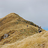
I was back in NZ for a week or so after Christmas and managed to fit in a walk in the Tararuas similar to the previous year. This time N. and I were joined by Chris and Kelly. My plan was to try and visit some of the more remote huts without revisiting too many that I'd been to already but with gales and snow forecast during the trip, I was willing to be flexible.

The map below shows our path as recorded by Chris's GPS and then plotted by GPS Visualizer and drawn again by everytrail.com (since I wasn't smart enough to figure out how to embed the GPS Visulalizer map directly). It's also possible to view the route in google earth by using it to open this file(25KB). The Google earth route is, perhaps, the most interesting since it also shows where we had to turn back one day when the weather got too bad (more on that later) and where the GPS was having trouble keeping track of our location down in Gullies and gorges.

See the full size map on the EveryTrail website.


Day One 30/12/09
Holdsworth Lodge up to Powell hut (3.25hrs) for lunch. Strong wind, but sunny from Powell to Holdsworth summit and then east over Isabelle to Mid Waiohine hut. Two hours from Powell to the bushline below Isabelle, another two hours descending to Mid Waiohine hut.


Day Two 31/12/09
Having descended about 1000 vertical metres the previous afternoon we started the day by climbing them again. We reached the summit of Aokaparangi, and the main ridge of the Tararuas in a pinch over four hours. It had snowed overnight down to about 1300m but there were only the smallest patches of snow under the tussock by the time we got to it.


After a short snack we pushed on to Anderson memorial hut (3hrs) for a late lunch.


We then continued north to Nichols hut (3.5 hr) reaching the hut just as the last light vanished and the weather started to close in.


With a bit over ten hours of walking, excluding breaks, this was our longest day; four hours shorter than the previous summer when N. and I had carried on to Dracophyllum biv, arriving there exhausted and wet, well after dark.

The following morning, clear(ish) skys showed the location of Nichols hut to be as spectacular as I had remembered from when we raced past it in the failing light 12 months earlier. It sits on a ledge above the Waiohine river and looks directly down the valley.


Day Three 1/1/10
Our plan was to drop off the side of the main ridge down to Park Forks. From reading around, this seemed to be a not uncommon way to get to Carkeek hut. A read of the hut book indicated that there was even a marked route with bits of blue tape showing the way down to the forks. Finding the start of the route took a bit of scrambling about and we didn't manage to follow the markers all the way down but they certainly sped up the travel.


A bit less then three and a half hours had us at Park Forks for lunch and a nap in the sun before we climbed up the spur to gain Carkeek ridge. The route here was not marked as well as that from Park Forks to Nichols, but it was reasonably easy to follow the old track even though it has been years since it was maintained. We arrived at Carkeek hut (2.25 hr) before the weather closed in totally and had a pleasant fire while the wind raged away outside.


Day Four, 2/1/10 Stuck!
The wind and rain continued through the night and showed no sign of dropping when we left the hut in the morning wearing all the clothes we had. What started as a slow battle staggering through the wind quickly got nasty when after an hour we found ourselves get chilled. The wind was sufficiently strong that it was necessary to crawl, or stagger slowly, hunched over, for much of the time. But moving so slowly meant that the rain and wind were all the more chilling. After an hour or so of battling, with no indication that the weather, or the terrain would improve, we headed back to the hut. I warmed up by chopping some more fire wood and we spent the afternoon playing 500, studying the map and trying to predict what the weather would do.

Day Five 3/1/10
Rain during the night and no sign of the wind dropping made us slow to get out of our sleeping bags in the morning. I had resigned myself spending another day stuck in the hut and was chopping more fire wood when I noticed that, even if the wind was just as strong, the rain was more sporadic. We packed quickly (including stuffing my camera deep inside my pack --- no photos from this part of the trip) and headed off. The wind was, if anything, stronger than the previous day --- several times I found myself crawling and for very little of this section was there any chance of walking upright. We reached the peak of Thompson after about five and a half hours. Half an hour more had us at the top of Pinnacle Spur. A gusty one and a half hours more had us at Arete Forks hut after crossing the Waingawa without difficulty despite the rain from the previous day.

Day Six, 4/1/10
Now that we were back down in the river valleys it was simply a case of us doing the distance to make up for our "rest day" to get out to the road end on the day we had planned. We had managed to call ahead from somewhere around the summit of Thompson and had arranged to be picked up from the Kiriwhakapapa road end, rather than at Holdsworth lodge as we had initially planed. Heavy rain over night had raised the level of the Waingawa, making us thankful we'd crossed it the previous evening. The sidle track from Arete Forks hut to Cow Creek hut involved about five an a half hours of up and down as we descended into stream gullies, climbed back out of them, and, in between, pushed our way though the trees that had come down in the storms of the early summer.


A quick lunch at Cow Creek and we were back on the track, climbing over the Blue Range. In all the excitement at the prospect clean clothes and a hot bath, I forgot to make a note of the time we arrived at the Kiriwhakapapa road end but I think it was around three hours after leaving Cow Creek.

More photos from the trip are in my Picasa gallery:

09-12 Tararuas


As are a few that Chris took:

10-01 Tararuas (Chris)


Clicking on the map below should take you to a full size version of it showing my hand drawn version of the route we took. The red spots roughly indicate the places where I recorded the times.


19 January, 2010

16 December, 2009

Roomie, Housie, Flatie

In Australia, flatmates (or roommates if you American) are housemates. So flaties become housies. Last night we had a housies Christmas dinner and secret Santa. (It seems that secret Santa is called Kris Kringle in Australia.) Anyway, lots of food and fun all round. And sing-along carols in a key of one's own choosing.


09-12 HousiesXmas