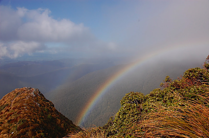
The next day we made good time up Rain Gauge Spur to Jumbo hut, the weather was pretty good by Tararua standards: windy saddles but calm other spots, a bit of clag about but enough visibility to see at least 100m or so ahead. And a rainbow.
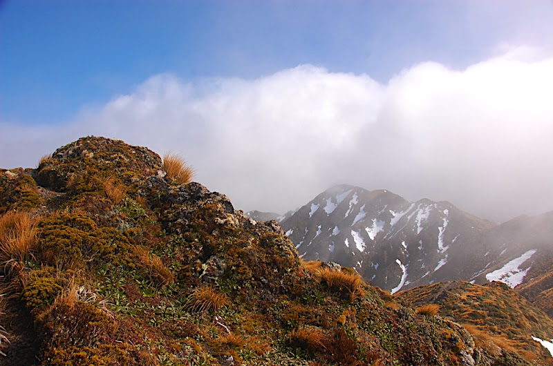
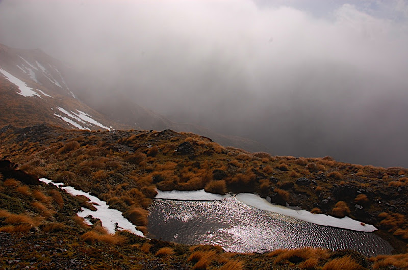
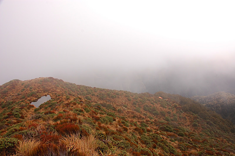
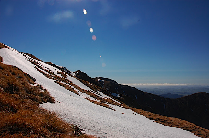
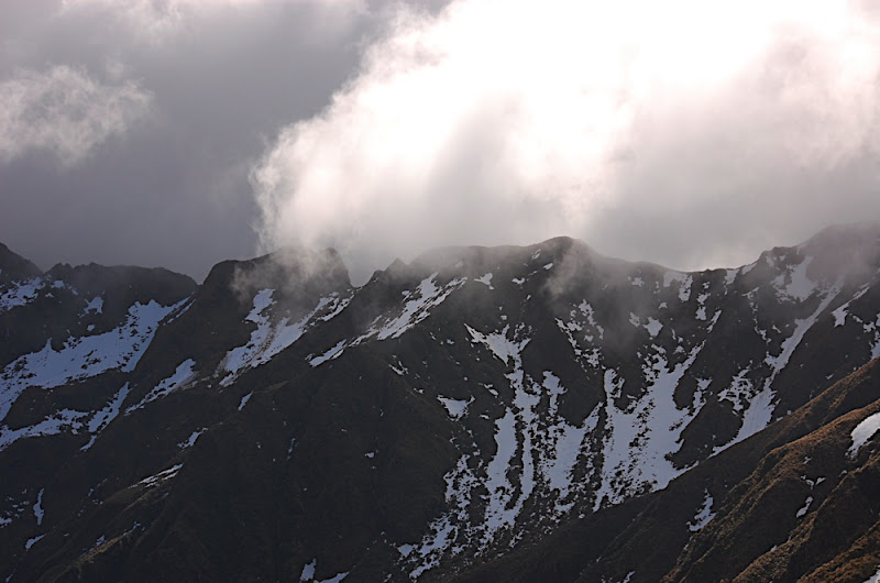
It was easy walking from Jumbo along the ridge to Angle Knob with some pretty looking trans formed from the snow melt. I hadn't been sure how much snow we would find here and we'd brought crampons. Although there were deep drifts off the side of the ridge (I'd say at least a metre deep in places) the track was clear apart from the odd patch. The cloud got a bit thicker about Angle Knob and the route seemed to vanish about ten metres after the peak.
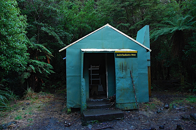
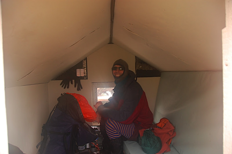
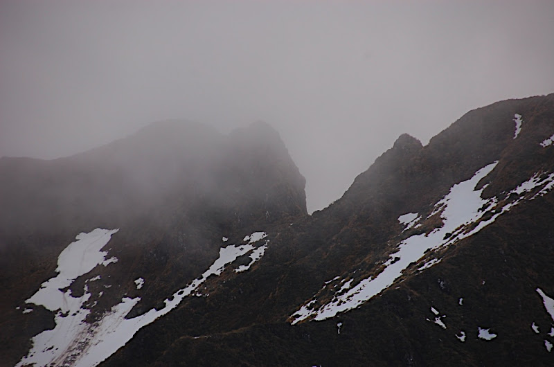
We'd seen a few reports in the Atiwhakatu hut book of people planning to visit the wreck so I'd expected the route from Angle Knob to continue as it had been up till then. We spent an hour or so scrambling about on some pretty steep and slippery (a nasty mix of snow and mud) pinnacle like things, making detours down the steep ridge sides and climbing back up when things didn't look any better down low. Eventually we decided that the cloud was too thick for us to be sure we were in fact on the easiest path, and the path itself was nasty enough for us to decide to back off and beat a retreat to the delightful two mattress McGregor Biv. Finding the biv itself was hard enough.It sits just at the bush line at the end of a spur from the ridge between Angle Knob and McGregor peak. The turn off down the spur isn't particularly marked and the valley between the ridge and the biv was full of cloud so Chris and I spent a while climbing about in tussock and Spaniard before a brief clearing in the cloud gave a view to the biv (I love forest service orange) --- on the slope opposite the one we were descending.
We reached the biv about two so we had plenty of time to enjoy the atmosphere of the cold, damp box that it was. Cloud meant still no views and little inclination to explore.
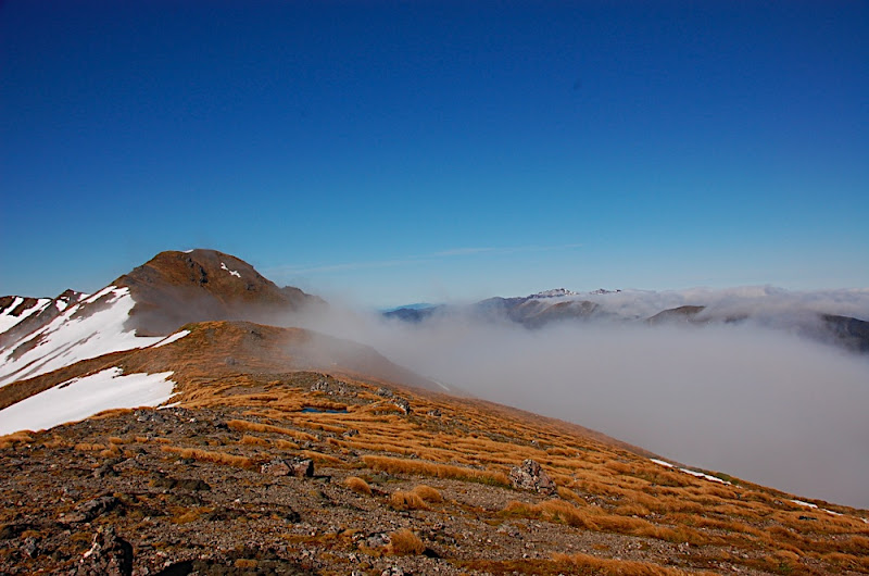
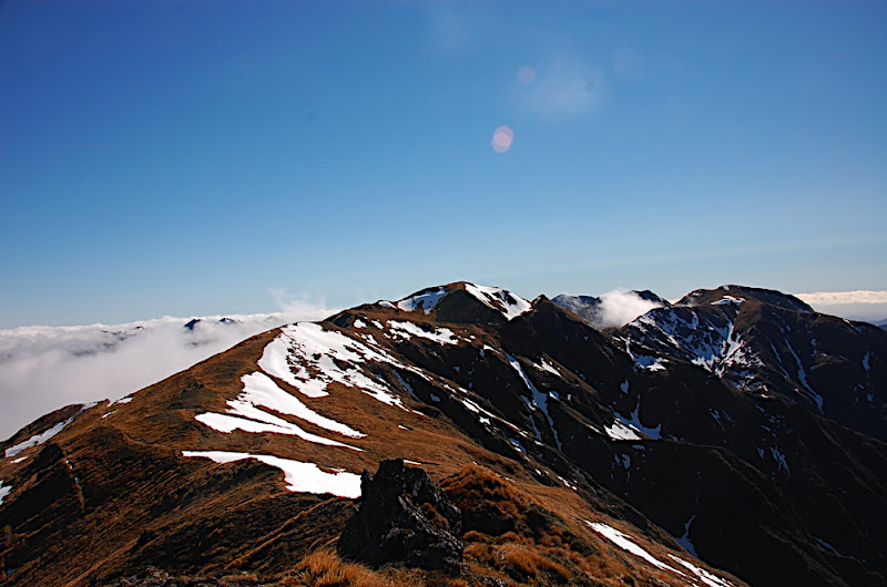
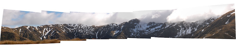
Sunday's weather was better with fewer clouds about. We had decided not to make another attempt to go to the wreck but by the time we had regained the saddle below Angle Knob the weather was looking so nice and we had such a good view of the route ('It doesn't look that bad at all!') that we were compelled to have another quick try. Once a again we scrambled about on the crumbly Tararua rock before deciding that the easiest route was just as steep and dodgy as we had previously thought (we hadn't dropped our packs for some reason) and we backed off again in favour of making a loop along McGregor Ridge and the Pinnacles to the South King and then to Baldy. If only we had known what was in store for us. The going at first was great. Nice views, plenty of sun and a route that felt isolated without being too difficult.
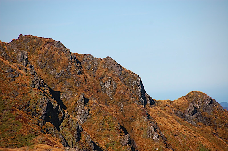

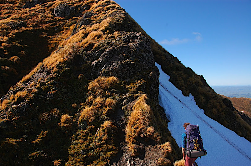
The first few pinnacles were good too; a bit exposed and scrambley with some steep ascents and descents that changed my opinion that this would be a route to take someone for their first trip in the tops. As we dropped off what we thought was the last pinnacle I was feeling that we had had a good amount of exposure and was looking forward to the route opening out a bit for the climb towards South King. As we climbed what I thought was the ridge a notch opened up in front of us. The knife blade we were walking along stopped pretty suddenly leaving us about 15 metres above the rest of the ridge. The sides of the ridge were steep enough to not look any easier than the climb down the face so with some reluctance and wishing that we had a rope to use with the iron ring that was hammered in at the top --- even if only for lower packs --- we slide, scrambled and generally squirmed our way down the face clutching at tussock and the wobbly rock features that pass for a good hold in the Tararuas. On reflection, the climb down was made much worse than it need have been by the fact that our heacy packs kept catching on things and pulling us off balance. The exposure made things feel worse too, below any of the ledges we climbed on to were large drops with nothing of substance to stop you if you were to slip, or a tussock hold was to let go.
Thankfully this really was the last difficult patch and was followed by a relatively easy climb up to a flat area where a spur split off the ridge, running down to Baldy. We needed a spot of lunch by this point.
From the spur down to Baldy we had nice views of the next valley, between South- and Mid-King and of ridge we had just walked along including the nasty notch. Baldy gave great views too --- in all directions.
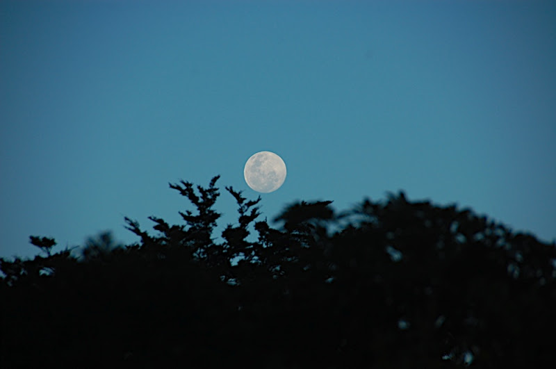
From here the track headed for the bush line and dropped down the the Mitre hut track, following the Atiwhakatu stream back to the hut and the carpark, just as the moon was rising.
Here's the Picasa gallery to go with the trip:
 |
| 08-09 Angle Knob |