Day 0: Romaric and I flew south, P.N. to Invercargill Friday afternoon. Invercargill seemed to be an angry town. My observations after a couple of hours there: people drive lots, walk little and there aren't any pedestrian crossings. A quick trip to the supermarket had us set for groceries for the next nine days. N meet us that night at the backpackers --- the kackling kea which is a nicer place than it's corny name would suggest. Our packs were looking quite heavy --- mine looked like it would be well over the 15kg limit for our luggage for out flight to Stewart Island so I took out most of the food and put it in the bag I planned to take as hand luggage.
Day 1: An early start had us waiting in the dark for the shuttle to the airport. Things looked pretty gusty (there was a a gale warning for Foveaux strait) and I fretted about whether our flight would be canceled. It seems gales are fine as long as they don't blow across the runway. In between hail squalls we made it out to the little eight seater plane (this includes the pilots) and into the air.
Our plan was to take a water taxi to Freshwater Landing hut at the far eand of Patterson inlet. The river from the inlet up to the hut is only deep enough for a boat at high tide, this was at 5pm so we spent the time in between on Ulva Island a predator free island in Paterson Inlet. This turned out to be a great part of the trip. We ate lunch with a weka,
saw kakariki,
and fed the S.I. robins who came hopping after us to eat the bugs we exposed when we scuffed up the dirt.
The island itself is particularly pretty. When the sun was out you could really think you were on some more northerly island in the Pacific.
Then ten minutes later you would be reminded that things weren't so tropical as a weka was blown past you through the air.
We also spied black oyster catchers, who tried to disguise themselves as rocks.
The weather started getting cold about three pm and by the time we were in the boat on the way to Freshwater hut I was wearing all my warm clothes. The hail squall that came through as we neared the hut was proof I wasn't just imagining things and by the time we got off the boat there was half a cm or so of hail on the ground.
It was about five pm by the time we started walking for the day. Romaric had walked this part of the track before and said it was boring. Besides, walking at night we'd have more chance of seeing kiwi right? The track crossed the swamp that drains much of the northern part of the island, following a canal. The heavy rain over the last couple of days meant that the track had turned into a canal of sorts too with knee deep water in more than a couple of places.
As promised, we did see two kiwi. They didn't seem that bothered by us and pecked around in the dry patches on the edge of the track for about 10 minutes before trotting off into the scrub. After that the track really was boring. Being dark might not have helped, but the most interesting thing after the kiwis was an abandoned woolshed from when someone had tried to run a farm on the west coast of the island.
We reached Mason bay hut about nine pm and surprised a dutch tramper who was sitting in the dark by himself. We weren't much company and went to bed after a quick dinner.
Day 2: We tried to make an early start since we expected a long day. The track to the next hut was posted as seven hours and I figured I was carrying 30Kg of stuff (the weight of me plus luggage was 30Kg more than my body weight when we got on the plane the day before). Despite out intentions the sun was nearly up when we set off --- after eight am. The forecast was for the tail end of yesterday's storm to rattle around the island. Things stayed pretty windy and there was still some hail about that hadn't melted from the previous day. From the hut, the track headed north, along the beach at Mason bay. The bad weather made things look suitably wild along the beach, the sand in the wind and the general gloom didn't make photos easy though.
We took a bit under an hour to reach the end of Mason bay where the track climbed steeply up the side of a bluff. Ropes hung down the steepest of the mud slides so you had something to hang onto.
Then it got flatter and the mud started.
That was about it for the next six hours until we reached Hellfire hut at the top of a giant sand dune. Japanese curry for dinner!
Day 3: Another dawn start, not that it matter much since we were under forest to begin with where it never gets that light on the brightest days. You don't need much light for picking your steps when your feet are under the mud anyway. The track for the day headed through forest down to West Ruggedy beach and along it then up a dune to East Ruggedy hut. The places all get their names from their proximity to the Ruggedy Range. Why Ruggedy?
That's why. The storm from the last two days had moved on by now but the wind was still pretty gusty --- enough to knock you off you feet in the gullies coming down to West Ruggedy beach. Certainly enough to get us to reconsider our plans of fishing off the rock at the beach end.
It was about two or three pm when we walked along the beach, not really dusk but late enough for the sun to be pretty low. Our presence at the beach was challenged by a tribe of black oyster catchers who tried to stare us down. I held my ground and eventually they backed down and ran away. I threatened them with my camera. They flew.
The walk from the beach up to East Ruggedy hut was pretty easy but the quicksand at the top of a sandy gully livened things up.
We'd been told that if we meet any it would only come up to our knees but the experience of sinking into heavy sand was still exciting even knowing you weren't going to be sucked down into the earth.
We reached the hut in a bit under the eight hours that the track was posted. For the second time on the trip we had to share a hut with other people (it was okay --- the hut slept a dozen or so no trouble). This time, a pair of women from the southern part of the South Island. One was walking the N.W. circuit for the eighth, or was it the ninth time.
Day 4: We managed a slightly earlier start this day --- on the track a bit before the sun was up --- in the hope of spotting some penguins on East Ruggedy beach when the sun came up. After sitting about in the wind for a while we gave up and headed on to Long Harry hut. The track crossed one bouldery beach and spent the rest of the time descending into and then climbing out of steep gullies and creek beds which made it slow going. Towards the end, the track came close to the tops of several sea cliffs, fifty or so meters above beautiful gold sandy beaches. The sun was out and we had some time to spare after our early start so we scrambled down a creek to one of the beaches and fished off some rocks in the hope of blue cod for dinner. Instead of blue cod we kept catching something else however. Fish about 25-30 cm long kept biting our hooks before we could get them deep enough for the blue cod to find them. We chucked most of the them back but kept three for dinner. After looking up fish online and at the library I think we were catching banded wrasse or kelpies. .
The ones we caught had pointy teeth sticking out the front which about half of the pictures I've found show. Banded wrasse is my best guess. Romaric caught some other bigger fish with a large head and huge gaping mouth about the size and shape of a fist. It looked too ugly to be good to eat so we threw him back too. I'm still not sure what it was. After some time in the library with fish books it seems it was either a scarpee or a stargazer. None of the pictures match it perfectly but then none of the pictures match those in the other books either so I shan't fret too much on the matter. In anycase, it was fun fishing --- I'd never caught anything other than eels before this. I didn't get any pictures to help with identification, maybe once Romaric is back he wills share the photos he took of me trying to fillet fish on the beach as the sandflies ate me. Oh, yes, the beach --- it was defiantly one of the prettiest that we saw on the island.
From where we were fishing it was only a Km or two to the hut. We could see it from from the top of the cliff, sitting on a cliff on the opposite end of a bay. The track to the hut was deceptive however, a couple of hours after fishing we finally arrived at the hut having climbed into and out of dozens of muddy gullies. This mostly meant hanging on to tree roots and using the thick mud at the bottom to cushion your step. Not much fun really as we had skipped lunch to go fishing and planned on a big dinner of fish with garlic that night.
Day 5: An early start again since we wanted to get to Yankee River Hut in time for lunch. The Long Harry hut was on a bluff above the sea on the North coast of the island so I got a couple of nice shots of the sun rising over the South Island as we were walking.
I didn't get any photos of the four kiwi we saw on the track though. They were scratching about even though it was daylight by the time we saw them. Two of the spent about 15 minutes snuffling in the ferns only a couple of meters away from us with only a spot of them ever viable at one time. I made do with fantails after that. They might be speedy but at least they come out where you can see them.
About morning-tea time we reached Smokey Beach, just the right time for a muesli bar a a few photos of the Smokey River winding coming out to meet the sea.
the kiwis had been out on the beach before, us leaving tracks all over the place. And well they might too; it was a pretty beach.
After that, it was more mud until we reached Yankee River hut.
The sandflies around Yankee River hut were aggressive so it wasn't much fun to sit still. Romaric and Nicola fished some more until they lost all our sinkers. I preferred to keep moving ahead of the sandflies and explored the rock pools.
That evening a yellow eyed penguin came up the beach outside the hut and waddled up the sand and into the bushes to go to bed. Romaric was busy taking photos of a tree as the penguin walked right in front of him so he missed it. He had the indignity to think that I was teasing him when I told him about it too. I got a couple of photos from further away at the hut. It is for exactly these moments that I had bought an 18-200mm lens!
The moonrise was quite pretty too.
Day 6: Another early breakfast; this time so that we could try to see the penguin from the day before when he came out of his burrow for breakfast and a morning swim. Even though I had my camera already for him this time I only managed to get a bunch of blurry photos. The sun rise before then made for much better pictures.
The sunrise was about all the sun we got that day. About when we started walking it started to drizzle and then rain and the rain some more until by the time we reached Christmas Village hut, six hour later, we were soaked through. We'd noticed in the hut books that since starting the tramp we had been one day behind a group of four trampers heading in the same direction as us. At Christmas Village we caught up with them as they'd spent the day making a side trip to the top of Mount Anglem. Thankfully, they were good people to share a hut with; fun to talk to and good at chopping wood and getting the fire roaring (Romaric complained about being too hot).
Day 7: Things were still looking a bit wet in the morning so N and I were skeptical of Romaric's plan to combine two the six hour side-trip to he top of Mt Anglem with the six hour walk to Bungaree hut. We sent him off on his own and mde our way at a leisurely speed. The vicious sandflies kept us from stopping on the beaches, nice as they were and with a small detour to look at some ruins from an old milling site we made it to Bungeree hut in about four and a half hours which gave some hope that Romaric would catch up with us before dark.
I guess we needn't have worried since Romaric turned up about eight hours after he had set off, shaving a respectable four hours off the 12 hours posted for the trip.
The beach at Bungaree Hut was once of the more interesting beaches on the trip with an island that had a system of three tunnels which join up in the centre and whcih you could walk through at low tide. There were lots of interesting shells and critters on the beach too. We found one pipi --- not quite enough for dinner --- and several paua who were all far too small to take.
Day 8: We really could have combined this day with the next one, were it not for the fact that we wanted to finish the tramp on a short day to allow us time to go to the pub before catching the plane. The three to four hours from Bungaree Hut to Port William hut too us a bit over two hours --- still plenty of time to get soaked however. The short walk also allowed us plenty of time to make pancakes for breakfast.
Port William hut was pretty busy with two groups of hunters and fishermen who'd come in by boat. They were all good sorts and one took Romaric out in dinghy to some deeper water so he could catch a couple of blue cod. We ate them fired in bread crumbs and olive oil when they were less than an hour out of the water. Tasty, tasty fish!
Day 9: From Port William back to Oban, the track follows part of a Great Walks track. You didn't need to know this to realise something was different though. The track changed from knee deep mud a gullies where you clambered up tree roots to a surface better than the bike lane on the side of Fitzherbert Ave in Palmerston North. Just to make it obvious that this was a seriously constructed track, a helicopter shuttled back and forth non-stop above our heads delivering workers and loads of gravel to smooth out any remaining bumps in time for the summer tourists.
We exited the track though one of the loops of the chain that is supposed to tether Stewart Island (Maui's anchor stone) to the South Island (Maui's Waka).
The walk from here, back along the roads, to Oban seemed particularly long. Maybe it was because we were so hungry and the thought of blue cod at the Oban hotel was weighing heavy on out minds...
After some editing I've managed to get my initial 1500 photos down to about 900, of those I've put a few up on my Picasa webalbum, sorted by day. Here they are:
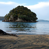 |
| 08-06-07 Stewart Island (Day1) |
 |
| 08-06-08 Stewart Island (Day2) |
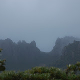 |
| 08-06-09 Stewart Island (Day3) |
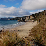 |
| 08-06-10 Stewart Island (Day4) |
 |
| 08-06-11 Stewart Island (Day5) |
 |
| 08-06-12 Stewart Island (Day6) |
 |
| 08-06-13 Stewart Island (Day7) |
 |
| 08-06-14 Stewart Island (Day8) |
 |
| 08-06-15 Stewart Island (Day9) |
No comments:
Post a Comment